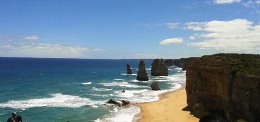

Image by freeaussiestock.com
Melbourne’s Docklands is one of the first major developments ever undertaken in the city, in 1855 the first docking port was built along the river at the point now known as Queens Bridge, this was a small riverside dock with limited capacity. Before settlement, this point was actually a small waterfall, and the point where the Yarra freshwater met the salt water estuary.
Upon settlement in 1835, when meeting with the aboriginal leaders and guides of the local tribes, known in affiliate as the Kulin nation, the Europeans were lead to the waterfall. Asking the Aboriginal guides the name of the river, they replied “Yarra Yarra”, translation “ever flowing”, hence the name of the river the Europeans adopted was the Yarra River.
Once better communication between the Woiwurrung (or Wurundjeri) tribes people was established, it was learned the “Yarra yarra” or “Yarro” was in fact a reference to the waterfall, the river itself was know as “Birrarung”, which translates to “place of mists”.
The Yarra waterfall was deemed unsuitable for the early European visionaries, it greatly annoyed many town planners and those with authority, as it made crossing by boat impossible, and proved a hindrance for travel and trade. Early settlers also routinely crossed the river by foot, either wading through when the river was high, or crossing over the exposed rocks at times when the water flow had slowed. In 1960, a small wooden foot bridge was built at this location, to make passage by the individual somewhat easier.
To the settlers however, the waterfall began to pose a threat to expansion, so a simple plan was hatched to deal with this problem, dynamite. In 1883, the waterfall was blown up, and in 1889, the Queens Bridge was built, providing a very wide lane overpass suitable for horse and carriage.
This made trade and travel much easier for the settlers, but had unintended consequences. The freshwater stretches became filled with salt water, and the river quickly began eroding from between Queens Bridge and a secondary small waterfall located at a section called Dights Falls.

Photo by Robert Kerton
Dights Falls was well known to European settlers since it’s first exploration in 1803, when the river was travelled and documented from the Queens-bridge waterfall to Dights Falls.
Dights Falls was an important fishing spot for the local aboriginal people, with an abundance of eel, freshwater and migrating fish, crayfish and freshwater mussels. It is also known to be a place where members of various aboriginal tribes met to settle legal disputes under aboriginal law, and also a place where wives were exchanged between tribes.
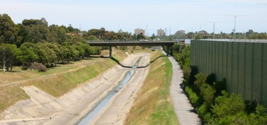
Dights Falls still exists today, but erosion and the requirements of preserving the freshwater barrier has meant man made weirs have replaced the original rocks and small waterfalls. Very recently a new fish migration channel has been built, and is showing signs of great success in sustaining migrating fish species, who require access to the estuary in order to breed.
Unfortunately the introduction of salt water up to and beyond Dights Falls (before a suitable man made barrier was built), along with altered water levels since the removal of the Yarra waterfall, means the river banks have sustained damage, the most obvious sign of this today is the fact the water runs a dark brown, with little to no visibility beyond around 15cm in depth. This is due to the clay being dislodged from river banks, which were previously protected by the constant freshwater presence. Before the Yarra waterfall at Queens Bridge was demolished, the Yarra River ran completely clear.
With the salt water estuary cleared in 1883, work had already begun 3 years earlier in 1880 on the new docklands to satisfy the requirements of the growing European colony. West Melbourne, now the freight centre of Melbourne, was originally a very large swamp, stretching across the region between the Maribyrnong river to Moonee Ponds Creek, and spanning the entire way to the Yarra River. The points as to where these swamps, lagoons and marshes were fed by these rivers were bricked up from 1835, in order to dry the land and make development possible.
Swampland was also present throughout most of what is now known as Port Melbourne, South Melbourne, Southbank, Albert Park and St. Kilda. These sections were bricked and separated before removal of the Yarra waterfall, what remained was a very large lagoon, today it is known as Albert Park Lake.
Although this lagoon that formed was large, it was not very deep at all, at around 1 meter at most. It was however decided the lagoon would stay and become a lake. In 1940, work was completed to seal and fill the sides of the lagoon so that the surrounding areas could be used as farmland, housing and grazing. Although complete throughout the 1940’s and 50’s, and with this southern region of Melbourne well settled during this time, it was not declared a public park until 1864. The name Albert Park was made in honour of Queen Victoria’s husband, Prince Albert.

Yarra River prior to 1880
In the West Melbourne swamplands, the land dried out significantly between 1835 and 1840, so much so that the founder of Melbourne, John Batman, built his residence in today’s Docklands region. Though unlike the southern region around Albert Park, West Melbourne was largely disused, with the exception of a few squatters huts, the northern section was used for rail in the late 1960s.
In 1970, it was proposed the Hoddle Grid, known today as the Melbourne CBD, be extended throughout West Melbourne. Grand plans were put forward, the highest of which was expansion and a lake replicated to appear in the shape of the United Kingdom, these plans were however abandoned and the Hoddle Grid was instead built further north.
With industry growing at rapid pace since the introduction of rail direct to the city centre, it was decided West Melbourne would become a replacement for the fairly insignificant and difficult to maintain section alongside the Yarra River at Queens Bridge, known at the time as Victoria Dock.
With little remnants of the old swamplands remaining in West Melbourne, plans began for shaping and channelling the region, so it could sustain extremely high traffic, be deep enough for the largest ships, and sustain growth long into the future.
In order to begin development, land was cleared and channelled south of the Mooney Ponds Creek, into the shapes of two single channels, combining into one main and exiting to the Yarra River. The water from the Yarra was blocked during the build, the sections for North Wharf, Central Pier and Victoria Dock involved removing 2.3 million cubic metres of earth, which was spread across the remaining West Melbourne swamp to improve ground quality, however much more was brought in from other regions in order to raise the surrounding regions to cope with the new Yarra River water passage.
During this time, the Yarra river was diverted from it’s regular route, to a new, easier to access corridor. The Yarra river originally ran upwards from Mooney Ponds Creek, roughly following Coode Road to the present location of Melbourne Market, from there it curved and angled downwards, joining what is now the Maribyrnong River at the present day Coode Road / Mackenzie Road junction. This junction and the river below was originally the junction and passage of the Yarra River.

Yarra River Docklands in 1882
To enable access for shipping vessels to the new docklands, the land between the present day Bolte Bridge and the Maribyrnong River, was channelled heavily. This became the new route of the Yarra River, with the old Yarra River now becoming just a creek, in between the Maribyrnong and the Mooney Ponds Creek. The small island created by this method was named Coode Island.
Once water was released into the new docklands development, it was given the name Victoria Dock, which was previously used on the small riverside docks at Queens Bridge.
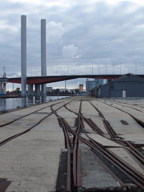
Today these ‘new’ Docklands are known as Victoria Harbour, with a business and residential development known as New Quay residing in place of the old transport depots. North Wharf still remains in place, however the docks on the Yarra River side are classed as condemned, and are expected to be demolished in the near future. Access to the Victoria Harbour side of North Wharf still remains in good order, the old light rail lines are still in place and there is a lot of extremely good fishing spots along here, when dropping bait or lures beside the pylons.
This development however was not enough to satisfy the needs of a growing city and an expanding technology, in 1950 with the creation of standardised shipping containers, Victoria Harbour became inadequate for the more modern, larger and longer container ships, which require direct access to dock in a straight and wide passage.
Unable to manoeuvre these ships within the narrow, angular and small Victoria Harbour, the last remaining vacant inner city land at West Melbourne, located west of today’s Bolte Bridge, up to the point of the Maribyrnong River, was diverted into a more modern docking facility. During this process, the original Yarra River path around Coode Island was filled in with earth, and paved over with tarmac to create space for container freight of a modern and busy capital city.